Kyambogo Study Projects Larger Floods for Kasese’s Nyamugasani Basin Under Climate Change
Engineers at Kyambogo University modelled future flooding in the River Nyamugasani Basin and found that, under a high-emissions scenario, the 100-year flood flow and the number of people exposed could rise sharply.

By Researchnews.Africa Desk
· 2 min read
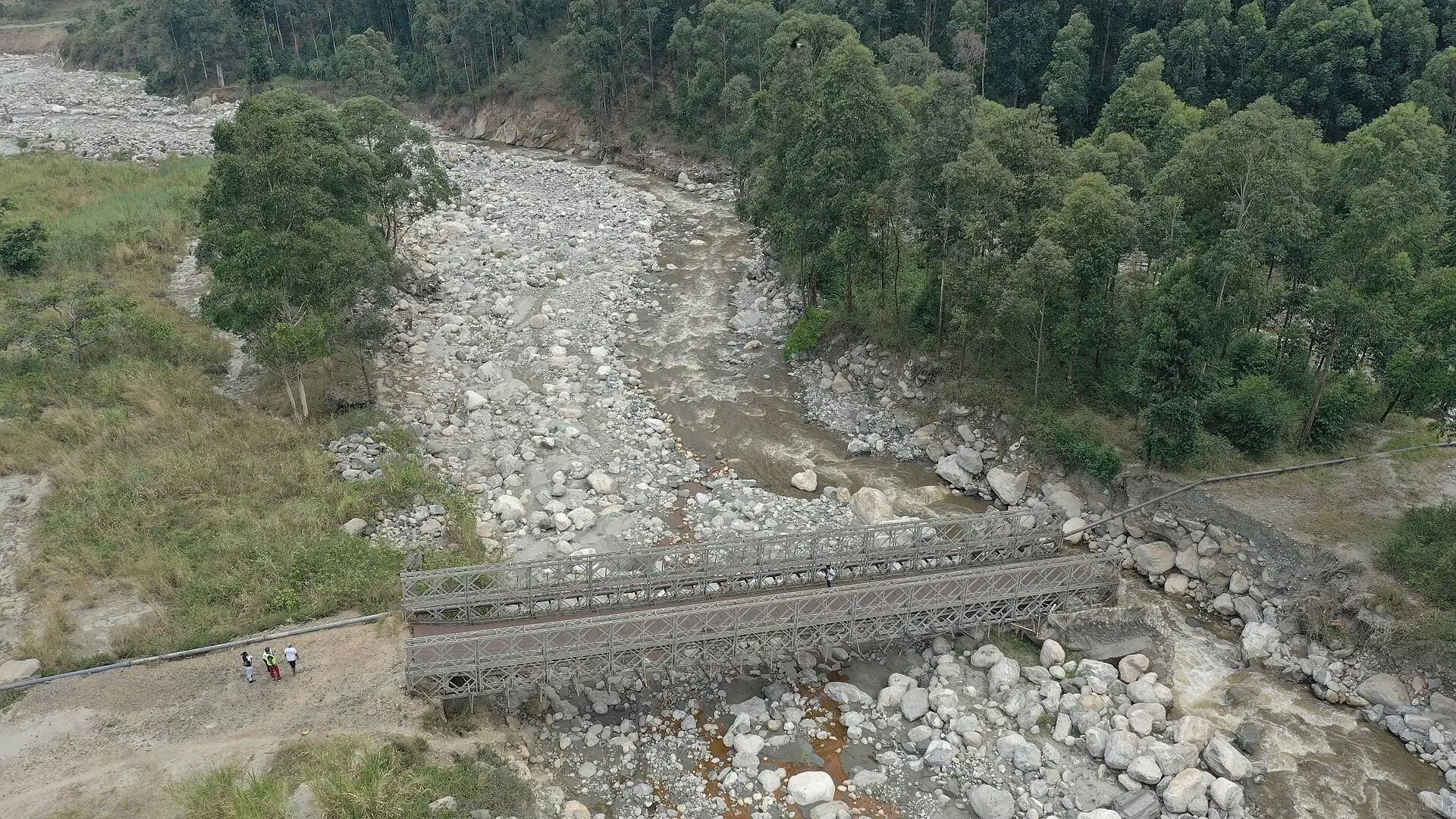
Flooding along the River Nyamugasani in Uganda’s Rwenzori region could become considerably more severe as the climate warms, according to a modelling study by researchers at Kyambogo University published on 7 November in Discover Applied Sciences.
The study was led by Arnold Betungura of Kyambogo University’s Department of Civil and Environmental Engineering, with Ambrose Mubialiwo and Hellen Aluku, who are also affiliated with Soroti University.
How the study was done
The team used rainfall projections from 11 global climate models under three emissions pathways, corrected for bias, to drive a hydrological model of the basin. They then mapped likely flood extents with a two-dimensional hydraulic model and combined the maps with population, land use and data on schools, health facilities and religious institutions. Household surveys in Kyarumba and Kisinga sub-counties of Kasese District, together with expert ratings, were used to rank flood management options.
What they found
Under the highest-emissions scenario, the estimated 100-year flood flow rose from 61.9 cubic metres per second at baseline to 126.0 cubic metres per second. The area flooded in such an event expanded from 16.05 to 22.96 square kilometres, and the number of people exposed rose from 4,862 to 6,956.
Direct physical losses to schools, health facilities and religious institutions were estimated at USD 1.91 million in June 2025 prices, within a sensitivity range of USD 1.09 million to USD 2.69 million.
Diversion channels and gabion revetments were the preferred structural measures, while flood forecasting and warning systems ranked highest among non-structural measures.
Why it matters
The authors say evidence for planning under future climate conditions has been limited for this part of the Rwenzori region, and that their results can support climate-informed floodplain zoning, protection of critical facilities, expanded forecasting and warning systems, and phased evaluation of engineering works.
Important limits
The authors are candid that their models could not be properly calibrated because observed river flow data were limited. The final flow series was produced from physically estimated parameters and could not be independently validated. They therefore advise that the discharge, flood extent, exposure and damage figures be read as scenario-based screening results, not as values for engineering design.
The article was published as an early, accepted version and may be revised before its final version of record.
Sources

About the writer
Researchnews.Africa Newsroom
Reporting by the Researchnews.Africa newsroom in Kampala.
All articles by Researchnews.Africa DeskResearchnews.Africa follows our editorial standards. Spotted an error? Tell us how to correct it.
Share this story